Why a Stack? Why Now?
When Hurricane Ida hit Louisiana in 2021, cell towers across eight parishes went dark within hours. Katrina was even worse. Every major crisis reveals the same fragility: the infrastructure we depend on for awareness — cellular networks, cloud services, GPS-assisted positioning — fails precisely when we need it most.
Anduril’s EagleEye platform proved the concept at military scale: fuse every available sensor into a single unified view, and operators make better decisions. The question Edge Orbital is answering: can we build the civilian equivalent — affordable, portable, and independent of centralized infrastructure?
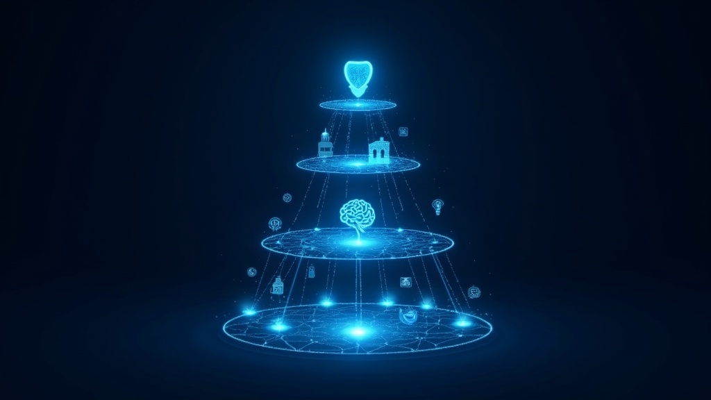
The answer is a four-layer stack. Each layer builds on the one below it.
Layer 1: Tessera Mesh — The Communications Backbone
Everything starts with transport. If devices can’t talk to each other, no amount of AI matters. Tessera Mesh is our patent-pending mesh networking protocol built on GPS-synchronized TDMA — a technique that eliminates packet collisions by giving each node a precise time slot, synchronized via GPS.
Why Mesh Is the Critical Missing Piece
Most “smart safety” products assume a working cell connection. That assumption kills them in exactly the scenarios where safety matters most: natural disasters, remote areas, large crowds that overwhelm towers, or adversarial environments where infrastructure is targeted.
Tessera Mesh works without cell towers, without internet, without cloud. Nodes communicate peer-to-peer using LoRa radio, hopping through the mesh to extend range. And because the protocol is GPS-synchronized, it achieves the spectral efficiency of a coordinated network without any central coordinator.
Proof of Concept: The $6 Solar Node
To prove the mesh can scale as autonomous infrastructure, we built a complete mesh node from a $6 solar garden light — solar panel, battery, microcontroller, and LoRa radio. Deploy a handful of these in a neighborhood, and you have a communications backbone that runs indefinitely with zero operating cost. That’s the foundation layer of the situational awareness technology stack.
Layer 2: Sensor Fusion — Every Device Feeds the Fabric
Once the mesh provides transport, the next question is: what data flows through it? The answer is every sensor the user already carries.
Phone
- GPS — continuous location with sub-meter accuracy (RTK-capable)
- Camera — visual scene analysis, QR/barcode scanning, license plate capture
- Accelerometer & Gyroscope — motion patterns, fall detection, vehicle crash detection
- Microphone — gunshot detection, glass break, anomalous sound classification
Smartwatch
- Heart rate & HRV — stress detection, medical event early warning
- Fall detection — automatic alert when the wearer goes down
- Wrist-based location — backup positioning when phone is stowed
- Haptic feedback — silent directional alerts without looking at a screen
Smart Glasses
- Forward-facing camera — persistent visual feed for computer vision
- AR overlay — threat indicators, waypoints, and safe zone boundaries rendered in the user’s field of view
- Head tracking — know where the user is looking, correlate with detected objects
The key insight: sensor fusion isn’t about any single device — it’s about combining all of them into a coherent picture. A phone’s GPS plus a watch’s heart rate plus glasses’ visual feed equals far more than the sum of their parts. The mesh carries this fused data between users, creating a shared awareness fabric.
Layer 3: AI & Spatial Intelligence — The Platform Learns
Raw sensor data is noise. Layer 3 turns it into intelligence.
Object Detection & Classification
On-device vision models identify people, vehicles, animals, and objects in real time. Running inference at the edge — on the phone or glasses themselves — means classification happens without cloud latency and without sending video over the network.
Anomaly Detection
The system learns what “normal” looks like for a given area and time. A person loitering near a school at 2 AM registers differently than a jogger at 7 AM. Sudden clustering of mesh nodes in an unusual pattern might indicate an emerging crowd event. Deviations from baseline trigger graduated alerts.
Geofencing & Predictive Threat Scoring
Users define safe zones — home, school, workplace. The AI layer monitors zone boundaries and calculates predictive threat scores based on historical patterns, current sensor data, and real-time mesh intelligence. A rising threat score triggers proactive alerts before an incident escalates.
Federated Learning Across the Mesh
Here’s where the mesh becomes more than transport: the AI improves from the collective. Anomaly models trained on anonymized data from thousands of mesh participants become far more accurate than any single device could achieve. The mesh is both the communications layer and the training ground.
Layer 4: The Safety View — 360° Real-Time Awareness
All of this culminates in what we call The Safety View: a real-time, 360-degree awareness display that shows you everything the stack knows.
On Your Phone
A map-based interface showing your position, nearby mesh participants (opt-in only), threat indicators, safe zone boundaries, and active alerts. Think of it as a personal tactical display — the same concept that Anduril’s EagleEye provides to military operators, scaled down to a smartphone.
On Smart Glasses
AR overlays that place threat indicators and navigation cues directly in your field of view. A red glow at the edge of your vision when the AI detects an anomaly behind you. Green waypoints guiding you toward the nearest safe zone. Opt-in tracking of your group members — see where your kids, your team, or your squad are without pulling out a phone.
What the Safety View Shows
- Threat indicators — directional alerts with severity levels
- Safe zones — geofenced areas with real-time status
- People tracking — opt-in location sharing for families, teams, and groups
- Environmental alerts — weather, air quality, emergency broadcasts relayed via mesh
- Historical patterns — “this area has elevated incident rates between 10 PM and 2 AM”
The Full Stack in Action
Imagine walking through an unfamiliar neighborhood at night. Your phone’s GPS and your watch’s sensors feed the mesh. Your glasses’ camera runs object detection. The AI layer compares what it sees against historical patterns for this area and time. A person approaches from behind — your glasses show a yellow indicator at your 6 o’clock. Your watch buzzes twice. The Safety View on your phone shows the person’s trajectory and a suggested alternate route.
None of this required a cell tower. None of it touched a cloud server. The mesh carried the data, the edge AI processed it, and the Safety View displayed it — all in real time, all decentralized.
That’s situational awareness technology built for civilians.
Coming Soon
The Situational Awareness Stack is under active development. Tessera Mesh is in prototype, sensor fusion pipelines are in design, and the AI layer is being trained on initial datasets. We’re building this in public because the technology is too important to develop behind closed doors.
Want to follow the build? Join our mailing list for development updates, technical deep-dives, and early access opportunities.
Edge Orbital is a technology research and development company. All surveillance and detection capabilities described herein are designed for lawful personal safety use. The publication of this technical information is protected under the First Amendment of the United States Constitution. Edge Orbital does not provide law enforcement services and is not a substitute for emergency services. Always call 911 in an emergency.
]]>